Future Earth Coasts: Cholera-Risk Information in Coastal Regions
A Future Earth-ESA COP26 joint project and an affiliated activity of Future Earth Coasts (FEC) in 2020-2021
Coastal communities worldwide are strongly affected by climate change through warming water temperature, sea-level rise, extreme weather events such as storm surges, coastal flooding, hurricanes, marine heat waves. These climate hazards pose major risks to wastewater and sanitation infrastructures, and access to safe water, which combined with changes in environmental conditions can affect emergence of climate-sensitive pathogens such as Vibrio cholerae and associated risk of cholera disease outbreaks. Cholera is affecting 1.3 to 4 million people each year worldwide, with up to 143,000 reported fatalities (World Health Organisation WHO). Increasing availability and quality of Earth observations (EO) have played major roles in helping coastal communities to adapt to climate change and risk of disease outbreaks, for example by providing early-warning systems.
Here, the project ‘Pathways Of Dispersal for Cholera And Solution Tools DEMOnstrator (PODCAST-DEMO)’ had been proposed with the aim to develop a proof-of-concept web-based visualization and analysis tool to provide local populations and public health authorities with information on climate-driven cholera risk in coastal regions of the northern Indian Ocean with a particular focus in India. In this project, Cholera-risk information has been generated based on pilot models (Campbell et al., 2020; Ogata et al., 2021) that use systematic observations of key climate indicators from ESA’s Climate Change Initiative (CCI), Copernicus Marine Environment Monitoring Service (CMEMS) and reanalysis product ERA-Interim from the European Centre for Medium-Range Weather Forecasts (ECMWF), together with epidemiological clinical data from publicly available archives of the Integrated Disease Surveillance Programme (IDSP) in India.
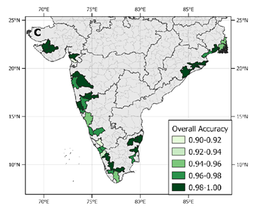
The project identified five satellite-derived climate variables as strong predictors of cholera disease outbreaks in coastal communities, including the Essential Climate Variables Land Surface Temperature, Chlorophyll a Concentration, Sea Surface Salinity, Sea Level Anomalies and Soil Moisture. The pilot model of Campbell et al., 2020, which used Machine Learning techniques, was able to detect with 89.5% accuracy endemic-cholera outbreaks in coastal India (Figure 1). Further, from the results of the users’ consultation survey that was carried out during the project, the researchers were able to highlight the importance of including socio-economic data and extreme events in the analysis to improve future developments of cholera-risk forecasts.
“There is an important need to analyse in combination Earth Observations, socio-economic and health data to develop most accurate early-warning systems that can help coastal communities and health officials to implement preventative measures and so reduce risk for human health,” says Marie-Fanny Racault, who is now based at University of East Anglia in Norwich UK and was leading the PODCAST-DEMO project.
The project has been led by Plymouth Marine Laboratory (UK), with support from the ESA-Future Earth Joint Programme grant for the PODCAST-DEMOnstrator project, and the United Kingdom Research and Innovation (UKRI) Towards a Sustainable Earth (TaSE) program to the PODCAST project. The project was conducted by an international team of researchers from UK, India and Japan, working with coastal communities and health authorities, with advice from researchers in Future Earth Coasts and the Health Knowledge Action Network.
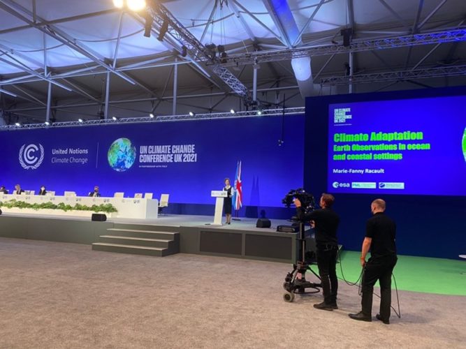
A web portal has been developed as a proof-of-concept, and the project has been presented to the UN Coordination of Humanitarian Affairs and UNFCCC COP26 Earth Information Day (photo below).
References:
- M. Campbell, M.-F. Racault, S. Goult, and A. Laurenson, ‘Cholera Risk: A Machine Learning Approach Applied to Essential Climate Variables’, 2020, International Journal of Environmental Research and Public Health, vol. 17, no. 24. https://www.mdpi.com/1660-4601/17/24/9378[1]
- Ogata, M.-F. Racault, M. Nonaka, and S. Behera, ‘Climate Precursors of Satellite Water Marker Index for Spring Cholera Outbreak in Northern Bay of Bengal Coastal Regions’, 2021, International Journal of Environmental Research and Public Health, vol. 18, no. 19. https://www.mdpi.com/1660-4601/18/19/10201


DATE
December 20, 2021AUTHOR
Future Earth Staff MemberSHARE WITH YOUR NETWORK
RELATED POSTS
Spotlight on LMICs – Tired of Breathing in Pollutants? Time for Better Fuel Economy and Vehicle Standards
Future Earth Taipei Holds 2024 Annual Symposium
Spotlight on LMICs – The Future’s Juggernaut: Positioning Research as Anchors for Environmental Health